Lemosho Route
The Lemosho Route: Kilimanjaro’s Most Scenic and Rewarding Path
The Finest Journey on Africa’s Greatest Mountain
Among all the routes that ascend the magnificent slopes of Mount Kilimanjaro, the Lemosho Route occupies a position of particular distinction and particular reverence among experienced trekkers, seasoned guides, and Kilimanjaro specialists who have spent years studying and walking every path the mountain has to offer. It is widely and consistently regarded as the finest route on Kilimanjaro — not simply because of its extraordinary scenery, though that alone would be sufficient justification for the claim, but because of the remarkable combination of qualities it brings together into a single, coherent, deeply satisfying trekking experience that no other route on the mountain can fully match.
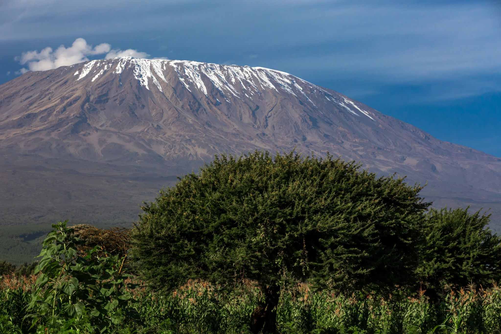
The Lemosho Route approaches Kilimanjaro from the far western side of the massif, beginning in a remote and seldom-visited section of the national park where the mountain feels genuinely wild, genuinely untamed, and genuinely far from the rest of the world. It crosses the magnificent Shira Plateau — one of the most hauntingly beautiful high-altitude landscapes in all of Africa — before joining the southern circuit and continuing eastward through a succession of extraordinary environments to the high camps and the summit. It is a route of genuine breadth and genuine depth, offering trekkers not merely a path to the summit but a comprehensive, immersive journey through the full ecological and geological complexity of Africa’s greatest mountain.
The Lemosho Route’s greatest practical virtue, beyond its unmatched scenic variety, is its superior acclimatisation profile. By approaching from the west and spending more days at intermediate altitudes before committing to the final summit push, the Lemosho Route allows the human body more time to adapt to the progressively thinner air of the upper mountain — a physiological advantage that translates directly into higher summit success rates and a safer, more enjoyable experience on the upper mountain. For trekkers who are prepared to invest the time and the commitment that the route demands, the Lemosho offers the best possible combination of natural beauty, physical challenge, and genuine summit prospects.
Route Overview: The Essential Facts
The Lemosho Route begins at the Londorossi Gate on the western side of Kilimanjaro National Park, located at approximately 2,100 metres above sea level and accessible by road from Arusha, typically via a journey of approximately four to five hours. The gate is considerably more remote than the Marangu Gate on the southeastern side of the mountain, and reaching it requires more logistical preparation — but the remoteness of the starting point is itself part of the Lemosho experience, signalling from the very beginning that this is a route that takes the mountain seriously and approaches it on its own terms.
The total distance of the Lemosho Route is approximately 56 to 70 kilometres depending on the specific variant taken — the longer figure applying to the extended northern variation that crosses more of the Shira Plateau before joining the main route. The standard recommended duration is seven to eight days, with the eight-day option providing the most comprehensive acclimatisation profile and the highest summit success rates. Some operators offer a nine-day Lemosho variant that incorporates additional acclimatisation time, and for trekkers who are known to be sensitive to altitude or who simply want to maximise their chances of summit success, the longer options are well worth the additional investment.
The total elevation gain from Londorossi Gate to Uhuru Peak is approximately 3,795 metres, and the route reaches its maximum altitude of 5,895 metres at Uhuru Peak on the summit day. The descent from the summit follows the Mweka Route on the southeastern side of the mountain — a steep, direct descent through extraordinary vegetation zones that provides an efficient and scenically rewarding return to the lower mountain.
The Climatic Zones and Temperatures on the Lemosho Route
The Lemosho Route passes through all five of Kilimanjaro’s distinct climatic zones, and because of its longer duration and more gradual ascent profile, trekkers on this route have more time to absorb and appreciate each zone’s distinctive character than on any other path on the mountain.
In the montane forest zone between approximately 2,100 and 2,800 metres, temperatures during walking hours typically range between 12°C and 22°C, dropping to 8°C to 14°C at night. Rainfall is frequent in the forest zone, particularly in the afternoons, and waterproof clothing is essential from the very first day. The forest on the western side of Kilimanjaro, through which the Lemosho Route passes in its opening section, is notably less visited than the forest on the southern Marangu approach and has a quality of genuine wildness and pristine beauty that more heavily trafficked routes cannot match.
On the Shira Plateau and through the heath and moorland zone between approximately 3,500 and 4,000 metres, daytime temperatures typically range between 5°C and 15°C, with nights dropping to 0°C to -5°C at the higher camps. The plateau is exposed to wind, and the wind chill can make the effective temperature feel significantly colder than the air temperature alone suggests. Full insulating layers and a windproof outer shell are essential from the second night onward.
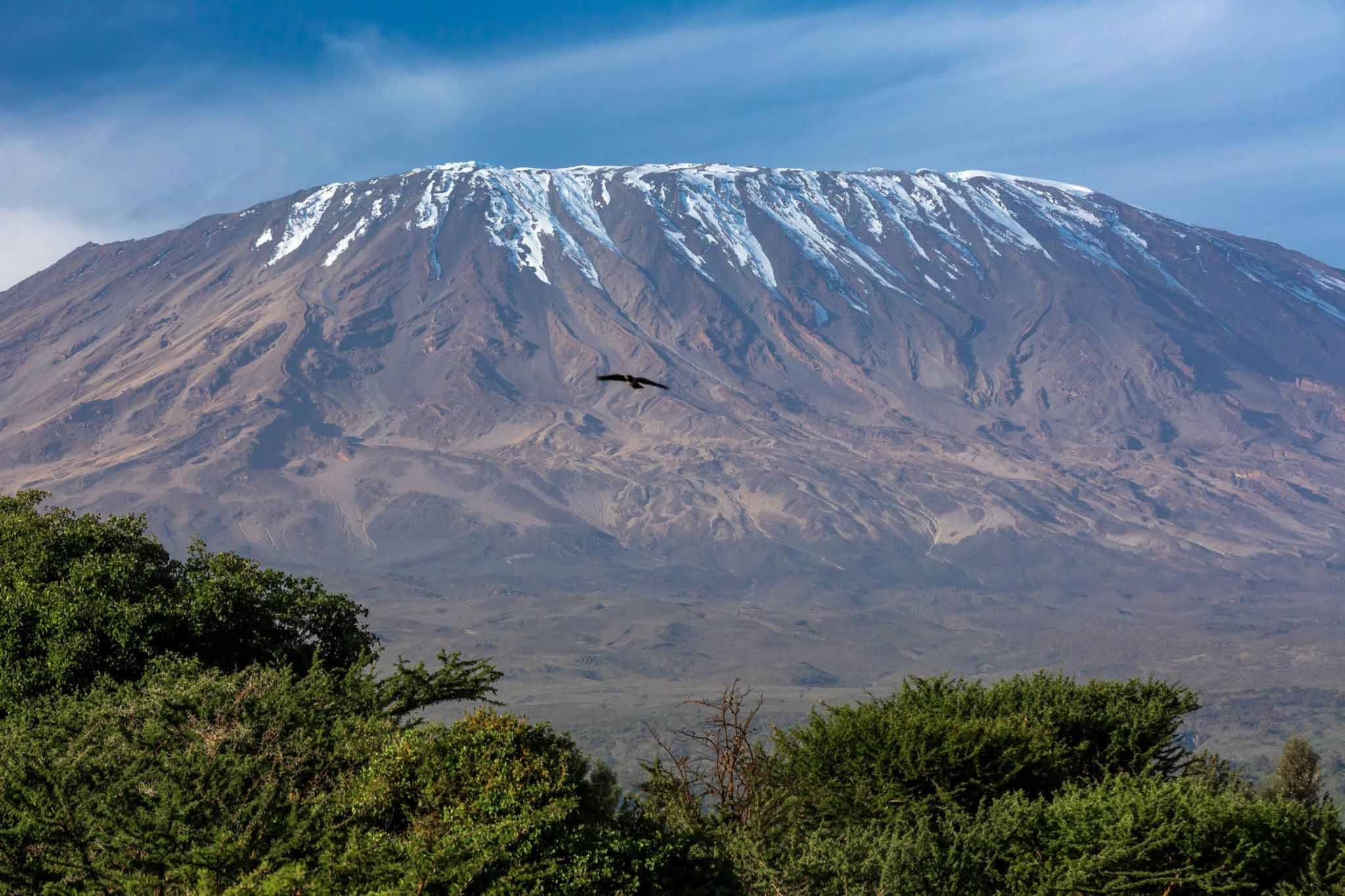
In the alpine desert zone above 4,000 metres, daytime temperatures range between -2°C and 8°C depending on cloud cover and wind speed, and night-time temperatures at the high camps of Barafu and Kosovo drop to between -8°C and -15°C. On the summit at 5,895 metres, temperatures during the pre-dawn summit push typically fall between -15°C and -25°C, with wind chill potentially driving the effective temperature below -30°C on exposed sections of the crater rim.
Day by Day: The Complete Lemosho Route Experience
Day One: Londorossi Gate to Big Tree Camp
The first day of the Lemosho Route begins with the registration procedures at Londorossi Gate at 2,100 metres — a process that can take an hour or more as guides, porters, and equipment are registered with the national park authority. From the gate, the path enters the montane rainforest almost immediately, climbing gently through one of the most pristine and least-visited sections of Kilimanjaro’s forest belt.
The walk on day one covers approximately 5 kilometres and gains approximately 600 metres of elevation, arriving at Big Tree Camp — also known as Forest Camp — at approximately 2,650 metres. Walking time is typically two to three hours, making day one a gentle and relatively short introduction to the mountain — an intentional design feature that allows trekkers to arrive at camp with time and energy to settle in, meet their guides and crew, and begin the important process of hydrating, eating well, and mentally preparing for the days ahead.
The forest on the Lemosho Route’s opening section is extraordinary — ancient trees of enormous girth draped in hanging mosses, a dense understorey of ferns and flowering plants, the constant, layered symphony of birdsong from above, and the frequent rustle of unseen movement in the undergrowth. The western forest of Kilimanjaro is notably richer in wildlife than the more visited southern sections, and sightings of blue monkeys, colobus monkeys, and a remarkable variety of forest birds are common. The atmosphere of genuine wildness and remoteness is palpable from the very first steps, and it establishes immediately the character that distinguishes the Lemosho Route from every other path on the mountain.
Big Tree Camp sits in a beautiful forest clearing, its name derived from the enormous, ancient trees that frame the campsite with a cathedral grandeur. Temperatures at camp in the evening drop to between 8°C and 12°C, and the night sounds of the forest — insects, nightjars, the occasional distant bark of a bushbuck — provide a richly atmospheric soundtrack to the first night on the mountain.
Day Two: Big Tree Camp to Shira 1 Camp
Day two is one of the most dramatic and most rewarding days of the entire Lemosho Route — the day on which the forest gives way to the moorland and the mountain opens up in a panoramic, breathtaking revelation that stops trekkers in their tracks and makes them reach for their cameras with an urgency and a joy that no words can adequately capture.
The walk from Big Tree Camp at 2,650 metres to Shira 1 Camp at 3,500 metres covers approximately 8 kilometres and gains approximately 850 metres of elevation, with a walking time of typically four to six hours. The path climbs steadily through the transition zone between forest and moorland, the trees becoming progressively shorter and more widely spaced as altitude increases, the undergrowth opening up and the sky expanding overhead.
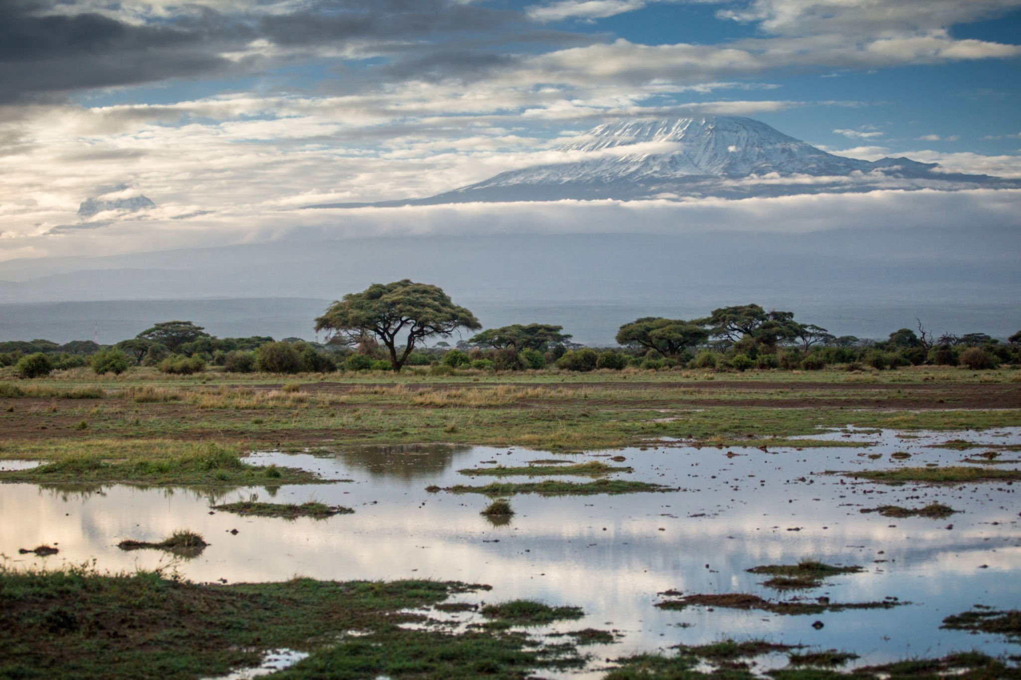
The emergence from the forest onto the open moorland is one of the great moments of the Kilimanjaro experience — a sudden, almost shocking expansion of space and light and view that produces an immediate and powerful emotional response. The Shira Plateau appears ahead, stretching away to the east in a vast, gently rolling expanse of moorland at an altitude that would qualify as a significant mountain in most of Europe, with the dramatic profile of the Kibo cone rising magnificently above it to the northeast. The scale of what lies ahead becomes suddenly, thrillingly apparent, and with it comes a mixture of awe, excitement, and the quiet, determined resolve that high mountains inspire in those who approach them with genuine respect.
Shira 1 Camp sits at the western edge of the Shira Plateau at 3,500 metres, with extraordinary views of the plateau stretching eastward and the Kibo cone rising in the background. The camp is exposed and can be cold and windy, with temperatures dropping to -2°C to -5°C on clear nights. The sunset from Shira 1 Camp, when the sky is clear, is a spectacle of extraordinary beauty — the western plains of Tanzania turning gold and then deep orange and crimson as the sun descends, the plateau bathed in warm, slanting light, and the first stars appearing above the darkening eastern sky.
Day Three: Shira 1 Camp to Shira 2 Camp
The third day of the Lemosho Route is a beautiful traverse across the Shira Plateau — one of the most extraordinary high-altitude landscapes in all of Africa and the most distinctive and memorable section of the entire route. The walk from Shira 1 Camp at 3,500 metres to Shira 2 Camp at 3,840 metres covers approximately 7 kilometres and gains approximately 340 metres of elevation, with a walking time of typically three to four hours.
The Shira Plateau is a landscape of haunting, otherworldly beauty — a broad, elevated plain formed from the ancient, eroded remains of Kilimanjaro’s oldest volcanic cone, carpeted with moorland vegetation of extraordinary character. Giant heathers up to five metres tall line sections of the path, their gnarled, moss-covered trunks creating a forest-in-miniature effect that is simultaneously beautiful and slightly eerie. Giant groundsels and giant lobelias appear in increasing numbers as altitude increases, their prehistoric silhouettes rising from the moorland like visitors from another geological era.
Many Lemosho Route operators incorporate an acclimatisation walk on day three, routing the path to climb briefly toward the Shira Cathedral — a dramatic volcanic rock formation on the southern edge of the plateau — before descending to Shira 2 Camp. This detour adds limited distance but valuable elevation gain and descent, applying the climb-high-sleep-low principle that is so central to successful altitude management on Kilimanjaro.
Temperatures at Shira 2 Camp are noticeably colder than at Shira 1, typically dropping to between -5°C and -8°C at night, with the plateau’s exposed position making wind chill a significant factor. The views from Shira 2 Camp are magnificent in every direction — the plateau spreading westward to the distant horizon, the Kibo cone rising directly ahead with an increasing impression of mass and height, and on clear evenings, the distant shimmer of the plains far below to the south and west.
Day Four: Shira 2 Camp to Barranco Camp via Lava Tower
Day four of the Lemosho Route is arguably the most important day of the entire trek from an acclimatisation perspective, and it is also one of the most scenically spectacular. The route on this day applies the climb-high-sleep-low principle in its most effective and most dramatic form, climbing to the extraordinary Lava Tower at 4,630 metres before descending to Barranco Camp at 3,960 metres for the night — a net loss of elevation despite a long and demanding day of walking.
The total distance covered on day four is approximately 10 kilometres, with a walking time of typically six to eight hours including the climb to and descent from Lava Tower. The day begins with the path climbing steadily from Shira 2 Camp across the upper plateau and into the alpine desert zone, the vegetation becoming progressively sparser and the landscape increasingly austere as altitude increases toward 4,000 metres and beyond.
Lava Tower is one of the most dramatic and most iconic geological features on Kilimanjaro — a massive, freestanding volcanic plug rising approximately 300 metres from the surrounding landscape at 4,630 metres, its dark, fractured rock face stark against the pale blue of the high-altitude sky. The climb to Lava Tower is the highest point most trekkers will have reached at this stage of the route, and many people experience the first significant symptoms of altitude here — headache, nausea, and breathlessness that go beyond simple exertion. Guides are attentive to their clients’ condition at Lava Tower, and the decision to push on toward the summit in subsequent days is informed by how trekkers respond to this altitude.
The descent from Lava Tower to Barranco Camp drops nearly 700 metres through extraordinary scenery — the Barranco Valley opening up below as a deep, lush, dramatic canyon with the towering Barranco Wall rising on the far side. The descent passes through increasingly rich vegetation, with giant groundsels and giant lobelias lining the path in extraordinary profusion, their extraordinary forms creating a landscape that feels genuinely prehistoric and genuinely unlike anywhere else on earth.
Barranco Camp at 3,960 metres is one of the most dramatically situated campsites on the entire mountain, nestled in the Barranco Valley with the enormous vertical face of the Barranco Wall rising directly above to the north and the extraordinary vegetation of the valley surrounding the campsite in every direction. The temperatures at Barranco Camp are somewhat warmer than at Shira 2 due to the sheltered valley position, typically dropping to between -3°C and -6°C at night, and the sense of being enclosed and protected by the valley walls after the exposed plateau adds a quality of comfort and intimacy to the camp that trekkers consistently describe as one of the highlights of the route.
Day Five: Barranco Camp to Karanga Camp via the Barranco Wall
Day five of the Lemosho Route begins with one of the most exhilarating and most memorable experiences on the entire mountain — the ascent of the Barranco Wall. This near-vertical section of the route rises approximately 300 metres from the valley floor in a series of scrambles and exposed traverses that require the use of hands and feet and produce a quality of focused, physical engagement that is quite different from the rhythmic, meditative walking of the lower sections of the route.
The Barranco Wall is not technically difficult — no ropes or climbing equipment are required, and the route up its face is well-worn and clearly defined — but it demands attention, physical confidence, and a willingness to commit to exposed moves on steep rock with a significant drop below. Guides assist trekkers through the more challenging sections, and the sense of collective achievement when the entire group reaches the top of the wall and turns to look back at the extraordinary view of the Barranco Valley below is one of the most jubilant moments of the entire Kilimanjaro experience.
From the top of the Barranco Wall, the path traverses the southern circuit of the mountain — a long, undulating traverse across the upper slopes of the southern face, with extraordinary views south across the plains of Tanzania and north toward the increasingly close summit of Kibo. The walk from Barranco Camp to Karanga Camp at 4,035 metres covers approximately 5 kilometres and takes typically four to five hours, including the Barranco Wall ascent.
Karanga Camp sits in a small valley on the southern face of the mountain at 4,035 metres, with water available from a nearby stream — one of the last reliable water sources on the ascent route. Temperatures at Karanga Camp drop to between -5°C and -10°C at night, and the wind on the exposed southern face can be significant. The camp offers good views of the summit above and the plains below, and the increasing proximity of the Kibo dome creates a growing sense of anticipation for the summit push that lies ahead.
Day Six: Karanga Camp to Barafu Camp
The sixth day of the Lemosho Route is a relatively short but psychologically significant day — the final approach to Barafu Camp, the highest camp on the route and the launch point for the summit push. The walk from Karanga Camp at 4,035 metres to Barafu Camp at 4,673 metres covers approximately 5 kilometres and gains approximately 638 metres of elevation, with a walking time of typically three to four hours.
The path climbs steadily through the upper alpine desert, the vegetation reduced to almost nothing and the landscape dominated by volcanic scree, bare rock, and the increasingly close walls of the southern ice fields above. The thin air at this altitude makes even the moderate gradient feel demanding, and the slow, deliberate pace that guides enforce on this section — the famous pole pole (slowly, slowly in Swahili) mantra of the Kilimanjaro guide — is not merely traditional but physiologically essential.
Barafu Camp at 4,673 metres is a large, exposed, frequently windswept campsite on a rocky ridge with extraordinary views of both the summit above and the southern plains below. It is not a comfortable or particularly pleasant place — the altitude, the cold, the wind, and the sparse, austere landscape conspire to create an environment of functional austerity rather than scenic pleasure — but it is the gateway to the summit, and its significance as the final staging point before the top of Africa gives it an atmosphere of focused, purposeful intensity that is deeply appropriate to the moment.
Temperatures at Barafu Camp drop to between -10°C and -15°C at night, and wind speeds can be significant on the exposed ridge. Trekkers are encouraged to eat a full meal and rest as much as possible in the late afternoon before the summit push begins between 11:00 PM and midnight.
Day Seven: Barafu Camp to Uhuru Peak and Descent to Mweka Camp
The summit day of the Lemosho Route follows the same path and produces the same extraordinary, life-defining experience described in the Marangu Route account — the midnight departure, the long, cold, breathtaking climb through the darkness, the arrival at Stella Point on the crater rim at 5,756 metres, and the final walk along the rim to Uhuru Peak at 5,895 metres as the sun rises over the Indian Ocean horizon and the plains of East Africa are revealed in the golden light of dawn far, far below.
After the summit, the descent follows the Mweka Route directly down the southeastern face of the mountain to Mweka Camp at 3,100 metres — a long, steep descent of approximately 2,795 metres over approximately 12 kilometres that typically takes between six and eight hours from the summit. The descent through the alpine desert and into the upper moorland and forest zones is physically demanding on the knees and ankles, and trekking poles are an invaluable aid on the steep, loose volcanic scree of the upper sections.
Day Eight: Mweka Camp to Mweka Gate
The final day of the Lemosho Route is a straightforward descent of approximately 10 kilometres from Mweka Camp at 3,100 metres to the Mweka Gate at approximately 1,640 metres, losing approximately 1,460 metres of elevation over a walking time of typically three to four hours. The path descends through beautiful forest, arriving at the gate where certificates are presented and the extraordinary journey of the Lemosho Route is formally and warmly concluded.
Why Choose the Lemosho Route?
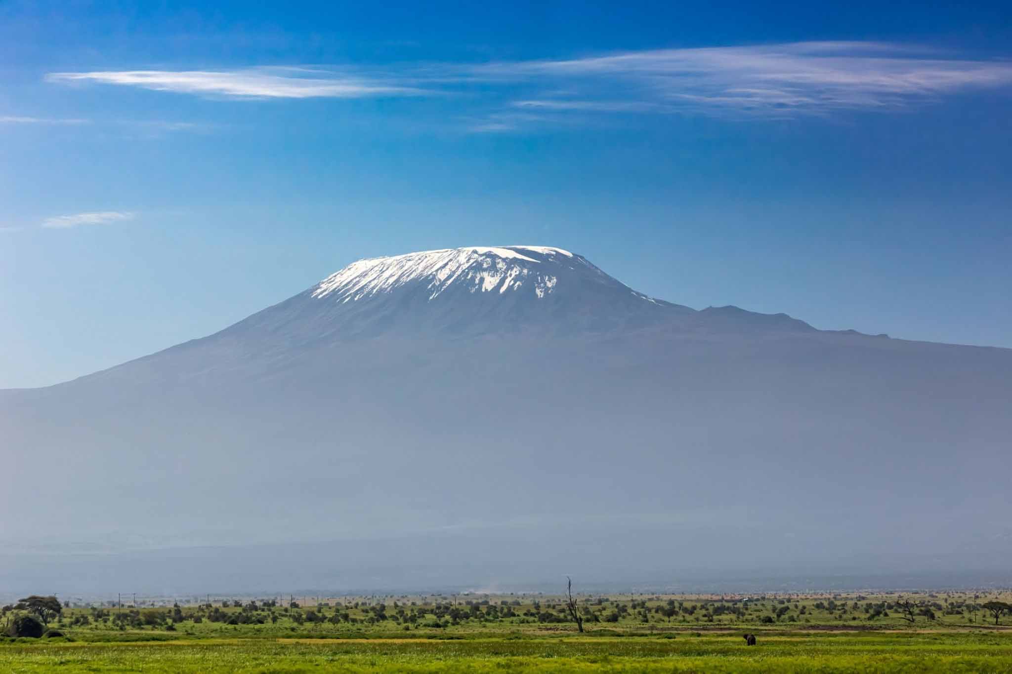
The Lemosho Route is the definitive choice for trekkers who want the finest possible combination of scenic beauty, acclimatisation quality, wildlife opportunity, and overall summit experience that Kilimanjaro has to offer. It demands more time and a greater financial investment than shorter routes, but the rewards — in terms of summit success rates, natural beauty encountered, and the depth and richness of the overall experience — justify every additional day and every additional dollar spent. If you climb Kilimanjaro once in your life, the Lemosho Route is the path most likely to give you everything the mountain has to offer.
Kilimanjaro Trips
Kilimanjaro Mountain Top Route
Marangu Route
Among all the paths that wind their way up the slopes of Mount Kilimanjaro, the Marangu Route holds...
Machame Route
If the Lemosho Route is the connoisseur’s choice — the route selected by those who...
The Rongai Route
The Rongai Route is the only route on Kilimanjaro that approaches from the north, beginning near...
Mweka Route
The Mweka Route is occasionally used as an ascent route primarily as part of the...


%20copy%203.svg)