Marangu Route
The Marangu Route: Kilimanjaro’s Classic Path to the Roof of Africa
The Route That Started It All
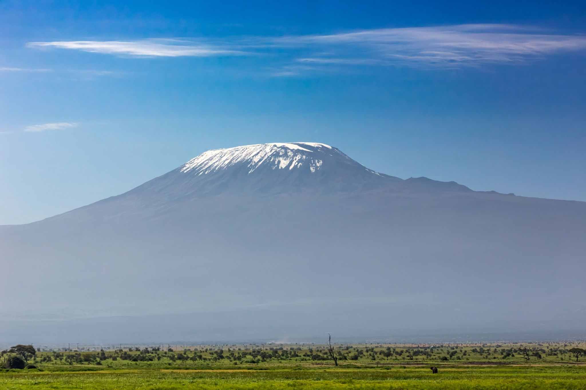
Among all the paths that wind their way up the slopes of Mount Kilimanjaro, the Marangu Route holds a special and irreplaceable place in the history and culture of the mountain. It is the oldest established route on Kilimanjaro, the first path to be formally developed for trekking tourism, and for many decades the only route available to climbers attempting to reach the summit of Africa’s highest peak. It is the route that introduced generations of adventurers to the extraordinary experience of climbing Kilimanjaro, and it remains today one of the most widely chosen and most deeply familiar paths on the mountain.
Known affectionately and widely by its nickname — the Coca-Cola Route — the Marangu Route earned this somewhat irreverent label through its reputation as the most straightforward, most comfortable, and most accessible path to Uhuru Peak. The nickname is not entirely fair, and it has perhaps done the route a disservice over the years by leading some trekkers to underestimate the genuine physical and physiological challenge it presents. Kilimanjaro is a serious mountain on every route, and the Marangu is no exception. But compared to the more technically demanding and more strenuous routes on the mountain, the Marangu does offer a gentler gradient, a more established infrastructure, and the unique comfort of sleeping in permanent huts rather than tents — features that make it a genuinely appealing and genuinely rewarding choice for a wide range of trekkers.
To walk the Marangu Route is to walk in the footsteps of more than a century of Kilimanjaro climbers — to follow a path that has been trodden by hundreds of thousands of adventurers from every corner of the world, each one drawn by the same ancient, irresistible call of the mountain and sustained by the same mixture of determination, wonder, and the quiet, daily courage that high-altitude trekking demands of every person who attempts it. It is a route rich in history, rich in natural beauty, and rich in the kind of hard-won, deeply personal experience that changes people in ways they carry forward for the rest of their lives.
Route Overview: The Essential Facts
Before diving into the day-by-day experience of the Marangu Route, it is helpful to understand its fundamental characteristics — the numbers, distances, and logistical realities that define it and distinguish it from the other routes on the mountain.
The Marangu Route begins and ends at the Marangu Gate, located on the southeastern side of Kilimanjaro National Park at an elevation of approximately 1,860 metres above sea level. The gate is situated near the small town of Marangu, approximately 40 kilometres from the city of Arusha and easily accessible by road, making it one of the most conveniently located entry points on the mountain.
The total round-trip distance of the Marangu Route is approximately 64 kilometres — making it notable as the only Kilimanjaro route that uses the same path for both ascent and descent rather than taking a different route down. This out-and-back configuration is one of the defining characteristics of the Marangu Route and has implications for both the trekking experience and the acclimatisation profile. The total elevation gain from the gate to Uhuru Peak is approximately 4,035 metres — a substantial ascent that places significant physiological demands on trekkers regardless of the route’s reputation for relative accessibility.
The standard duration for the Marangu Route is offered in two versions — a five-day option and a six-day option. The six-day version includes an additional acclimatisation day at Horombo Hut and is strongly recommended by virtually every experienced Kilimanjaro guide and operator. The difference in summit success rates between the five-day and six-day versions is significant — research consistently shows that the extra acclimatisation day makes a meaningful difference to the body’s ability to cope with the altitude of the upper mountain, and the marginal additional cost of one extra day on the mountain is one of the most valuable investments a Marangu Route trekker can make.
The maximum altitude reached during a normal summit attempt via the Marangu Route is 5,895 metres at Uhuru Peak, though trekkers who reach Stella Point on the crater rim at 5,756 metres are also considered to have successfully summited by the Tanzania National Parks Authority and receive a green summit certificate, compared to the gold certificate awarded to those who continue to Uhuru Peak itself.
Accommodation: The Huts of the Marangu Route
One of the most distinctive and most practically significant features of the Marangu Route is its system of permanent mountain huts — the only hut system on any Kilimanjaro route, and a feature that sets the Marangu experience apart from every other path on the mountain in a fundamental and practically important way. While all other Kilimanjaro routes require trekkers to sleep in tents, the Marangu Route offers dormitory-style sleeping in three permanent hut complexes, each situated at a key elevation point along the route.
The huts provide a level of shelter and comfort that tented camping in the cold, exposed conditions of the upper mountain simply cannot match. They protect trekkers from the wind and cold of high-altitude nights, provide communal dining areas where hot meals are served, and offer basic but functional toilet facilities. For trekkers who are concerned about the cold, who are travelling during the rainy season when wind and precipitation make camping on the upper mountain genuinely miserable, or who simply prefer the reassurance of solid walls and a roof over their heads at high altitude, the huts of the Marangu Route are a genuinely significant practical advantage.
It is important to note, however, that the huts are dormitory-style facilities rather than private rooms — each hut complex contains multiple sleeping structures, each with bunk beds shared among the trekking groups using the facility on any given night. The huts can feel crowded during peak season, and the communal nature of the sleeping arrangements means that privacy is limited and the noise and schedules of other trekking groups inevitably impinge on the experience to some degree. Trekkers who value privacy and solitude may find the social character of the Marangu huts less appealing than the private tents of other routes, but for those who enjoy the camaraderie of a shared adventure and the opportunity to meet fellow climbers from around the world, the huts have a distinctive and warmly human atmosphere.
Day One: Marangu Gate to Mandara Hut
Distance, Elevation, and Duration
The first day of the Marangu Route is a gentle and deeply beautiful introduction to the mountain — a walk of approximately 8 kilometres through the extraordinary montane rainforest of Kilimanjaro’s lower slopes, beginning at the Marangu Gate at 1,860 metres and ending at Mandara Hut at 2,720 metres. The total elevation gain on day one is approximately 860 metres, and the walking time is typically between three and four hours for most trekkers, making it one of the shorter and less demanding days of the entire route.
The Experience
The day begins with the formalities of registration at the Marangu Gate — the signing of the register, the briefing by your guide, the weighing of porters’ loads, and the administrative procedures of the national park. Once complete, the path enters the forest almost immediately, and the transformation is immediate and total. The noise and dust of the road fall away, replaced by the cool, green, enveloping silence of one of the most beautiful forests in East Africa.
The montane rainforest of Kilimanjaro’s lower slopes is a world of extraordinary sensory richness. The canopy is dense and high, filtering the equatorial sunlight into a diffused, golden-green luminescence that gives the forest an almost cathedral quality. The path winds upward through the trees at a comfortable gradient, well-maintained and clearly defined, with wooden boardwalks crossing the muddier sections and occasional rest points with benches where guides encourage trekkers to stop, breathe, and absorb the extraordinary environment around them.
The forest is alive with birdsong — the melodic, complex calls of dozens of species filling the air from every direction. Blue monkeys are regularly seen in the canopy overhead, peering down at passing trekkers with expressions of mild, aristocratic curiosity. The vegetation along the path is rich and varied — giant ferns line the lower sections, giving way to dense undergrowth of flowering plants, mosses, and lichens as altitude increases. The smell of the forest — damp earth, decomposing leaves, wild flowers, the clean, cool freshness of altitude air — is one of the most instantly evocative sensory experiences of the entire Kilimanjaro trek.
Temperatures on day one are warm and comfortable, typically ranging between 15°C and 22°C during the walking hours, dropping to 10°C to 15°C in the evening at Mandara Hut. Rain is possible at any time in the forest zone, and a waterproof jacket should always be accessible rather than packed at the bottom of a rucksack. The afternoon is the most likely time for rainfall, and many trekkers find that the forest walk has a light, misty quality that adds to its beauty and its atmosphere of green, enclosed magic.
Mandara Hut itself is a pleasant and well-maintained complex of A-frame wooden huts set in a small clearing in the forest, with a central dining and common room hut where meals are served and guides gather in the evenings. The facilities are basic but functional — bunk beds with mattresses in the sleeping huts, flush toilets, and running water in the communal washing areas. The clearing around the hut complex offers glimpses of the forest and, on clear evenings, the first distant views of the upper mountain rising above the canopy to the northwest.
A popular late-afternoon excursion from Mandara Hut, available to trekkers who arrive with time and energy to spare, is the short walk to the Maundi Crater — a small volcanic crater located just above the hut complex at approximately 2,780 metres. The walk to the crater and back takes approximately one hour and offers the first open, unobstructed views of the Kilimanjaro massif rising above the forest boundary — a view so dramatic and so beautiful that it instantly and completely justifies the effort of the excursion and sets the tone of wonder and anticipation for the days ahead.
Day Two: Mandara Hut to Horombo Hut
Distance, Elevation, and Duration
The second day of the Marangu Route is the longest and most varied day of the entire trek — a magnificent walk of approximately 12 kilometres from Mandara Hut at 2,720 metres to Horombo Hut at 3,720 metres, gaining approximately 1,000 metres of elevation over a walking time of typically five to seven hours. It is on day two that the landscape begins to change dramatically, the forest giving way to the extraordinary moorland and heathland of the mountain’s middle zones, and the views beginning to open up in a way that reveals for the first time the true scale and grandeur of the Kilimanjaro massif.
The Experience
The day begins with the path climbing steadily out of the forest and into the transition zone between the montane forest and the heath and moorland — a gradual, beautiful transformation in which the tall trees become shorter and more widely spaced, the undergrowth opens up, and the sky begins to appear in wider and wider patches above the diminishing canopy. The sense of space expanding as the forest releases its grip is one of the most exhilarating moments of the entire route, and many trekkers find themselves stopping frequently on this section simply to look around and absorb the changing landscape.
As the forest gives way completely to moorland, the giant heathers begin to appear — extraordinary tree-heath plants growing to five metres or more in height, their trunks wrapped in thick, orange-tinged mosses and their branches disappearing into the cloud and mist. The path winds between these ancient, gnarled plants in a landscape that has an almost fairy-tale quality, particularly when morning mist drifts through the heather and softens the light into a silvery, diffused luminescence.
Higher up, above approximately 3,000 metres, the first giant groundsels and giant lobelias begin to appear — those extraordinary, botanically unique plants that are among the most iconic and most memorable features of the Kilimanjaro experience. The giant groundsel, with its thick, woolly trunk and enormous rosette of leaves, is found nowhere else on earth, and seeing one for the first time produces a sensation of genuine botanical wonder that never quite fades no matter how many times you encounter them on the route.
Temperatures on day two drop noticeably from the warmth of the forest zone, typically ranging between 8°C and 15°C during walking hours, with a significant chill setting in by mid-afternoon when the cloud that frequently builds over the mountain during the day moves in and reduces visibility and temperature simultaneously. Trekkers who set off in morning sunshine often find themselves walking through mist and light drizzle by mid-afternoon, and an additional insulating layer and a waterproof jacket are standard equipment from day two onward.
The approach to Horombo Hut crosses a broad, open moorland plateau with increasingly dramatic views of both the Kibo and Mawenzi cones ahead — the snow-capped dome of Kibo rising to the northwest and the jagged, fractured profile of Mawenzi to the northeast, separated by the broad, high saddle that the route will cross on day three. The hut complex itself, situated in a small valley at 3,720 metres, is the largest on the Marangu Route — a collection of A-frame huts clustered around a central dining and toilet block, with magnificent views of Mawenzi visible from the clearing. The temperature at Horombo Hut in the evening drops to between 0°C and 5°C, and a warm fleece layer, hat, and gloves are essential for comfort after the day’s walking is complete.
Day Three (Six-Day Option): Acclimatisation Day at Horombo Hut
The Most Important Day on the Mountain
For trekkers following the recommended six-day version of the Marangu Route, day three is an acclimatisation day at Horombo Hut — a day with no upward progress, no new campsite to reach, and no distance target to achieve. It is, paradoxically, one of the most important and most valuable days of the entire trek, and trekkers who resist the temptation to push on and embrace the acclimatisation day with patience and good humour give themselves a significantly better chance of reaching the summit successfully.
The principle behind the acclimatisation day is simple and physiologically well-established. The human body adapts to altitude through a gradual process of physiological change — the production of additional red blood cells, adjustments to breathing rate and depth, changes in blood chemistry — that takes time and cannot be hurried. Spending an additional night at Horombo Hut at 3,720 metres allows these processes to advance, reducing the risk of altitude sickness on the upper mountain and improving the body’s ability to perform at the extreme altitudes of the summit zone.
The acclimatisation day is typically spent with a guided walk to the Zebra Rocks — a remarkable geological feature located at approximately 3,900 metres above the hut, a short walk up the Mawenzi ridge. The rocks earn their name from the extraordinary pattern of dark lava alternating with white mineral deposits that creates a striking zebra-stripe effect on the rock face. The walk to Zebra Rocks is a perfect acclimatisation exercise, climbing approximately 200 metres above the hut before returning to sleep at the same elevation — a practical application of the climb-high-sleep-low principle that forms the foundation of successful altitude management on Kilimanjaro.
Temperatures on the acclimatisation day are similar to those of day two — 8°C to 15°C during the daytime walk, dropping to near freezing at night. The views from the Zebra Rocks area on a clear day are extraordinary, with Mawenzi rising dramatically overhead and the broad, brown sweep of the Kilimanjaro saddle visible below, stretching toward the base of Kibo to the northwest.
Day Four: Horombo Hut to Kibo Hut
Distance, Elevation, and Duration
Day four of the Marangu Route is the day the landscape changes most dramatically and the physical demands of the altitude begin to assert themselves most clearly. The walk from Horombo Hut at 3,720 metres to Kibo Hut at 4,703 metres covers approximately 10 kilometres and gains approximately 983 metres of elevation, typically taking between five and seven hours to complete.
The Experience
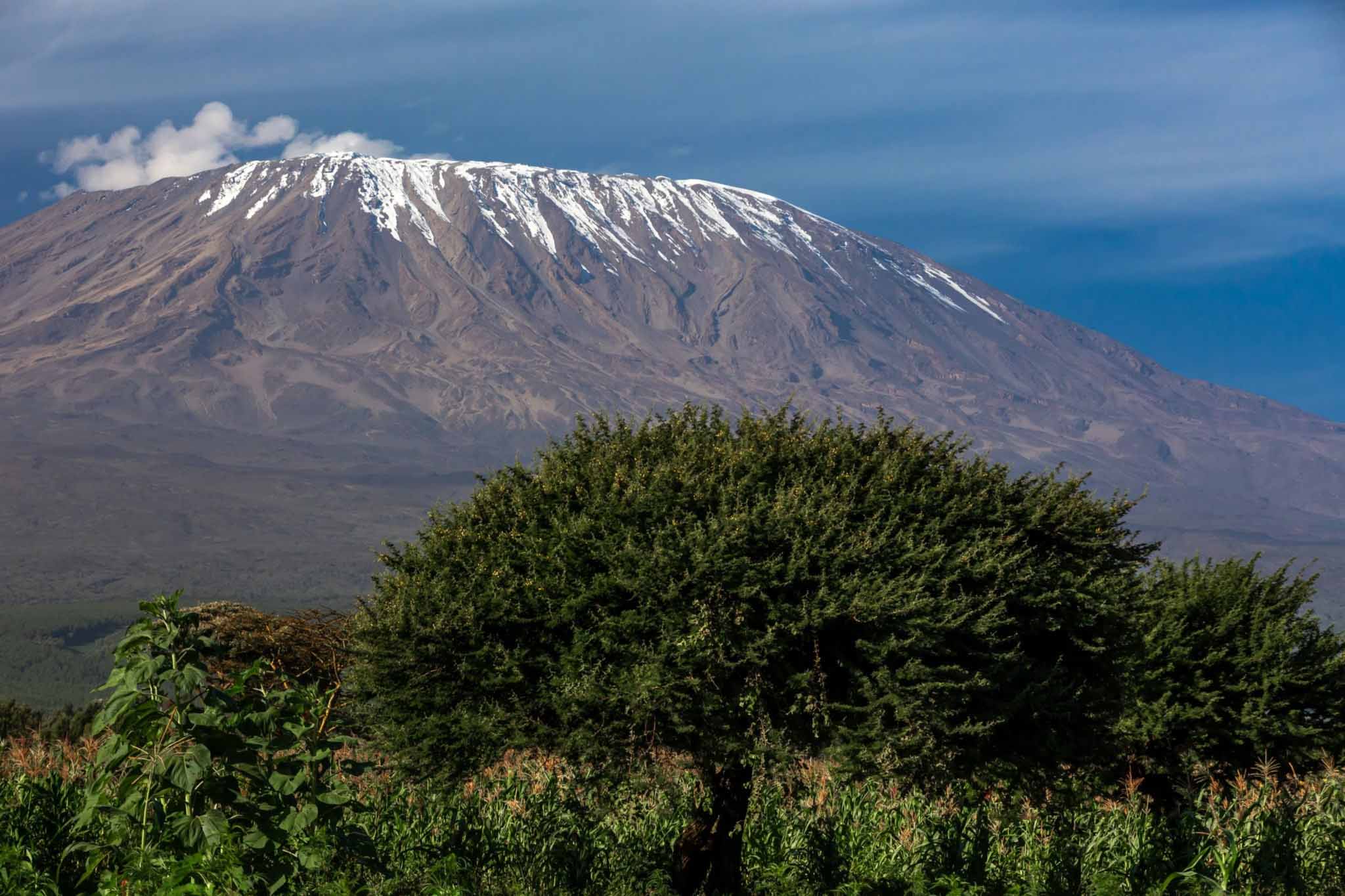
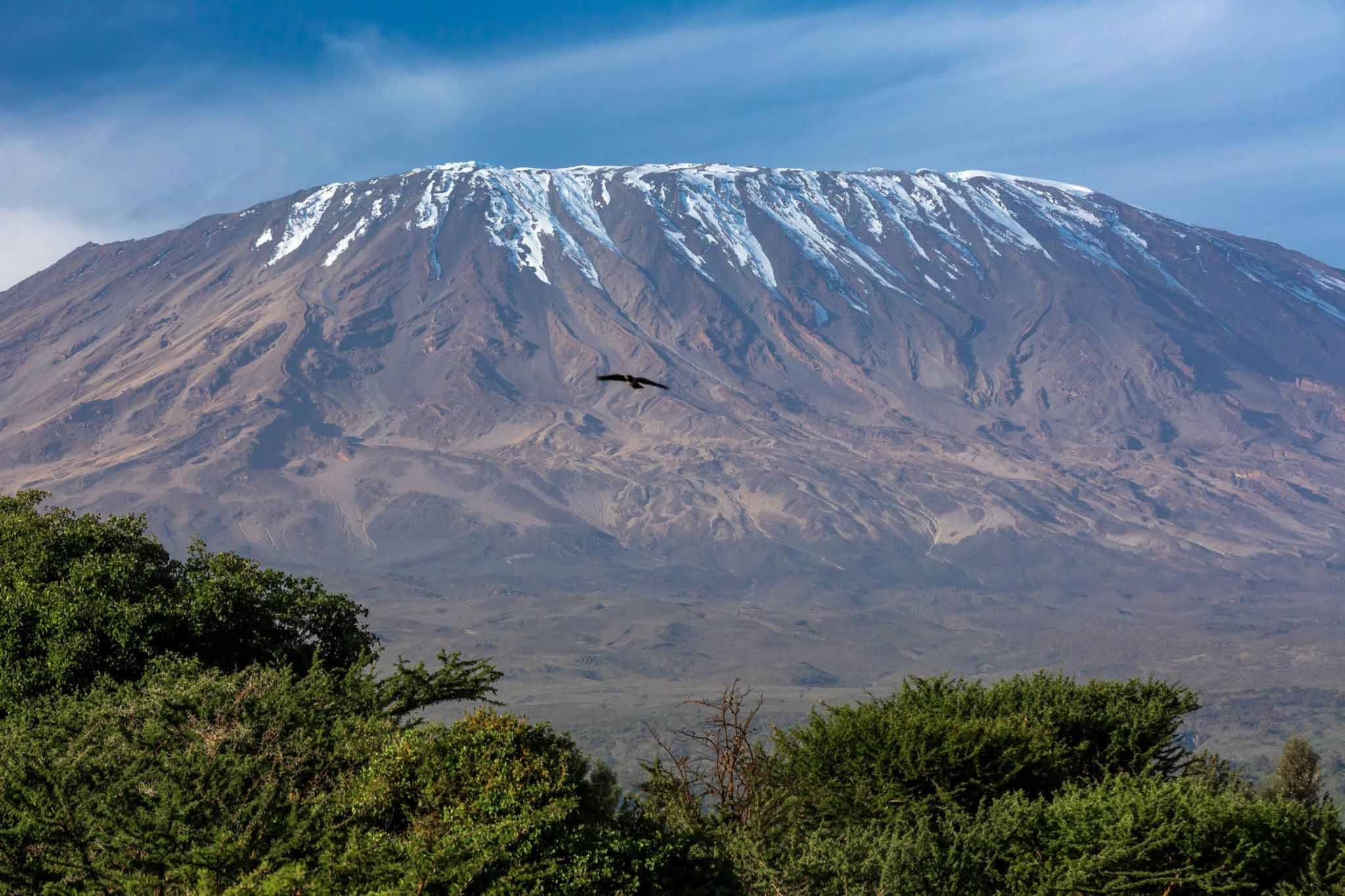
The path from Horombo climbs steadily through the last remnants of the moorland vegetation before entering the alpine desert zone — the stark, austere, visually dramatic landscape of sparse vegetation, volcanic scree, and thin, cold air that characterises Kilimanjaro’s upper mountain. The transition from the lush moorland to the alpine desert is one of the most striking landscape changes of the entire route, and many trekkers find that crossing this threshold produces a profound shift in the psychological character of the trek — the mountain suddenly feels more serious, more demanding, and more magnificent.
The route crosses the broad, brown expanse of the Kilimanjaro Saddle — the elevated plain separating the Kibo and Mawenzi cones at approximately 4,300 metres — in a long, exposed traverse that offers extraordinary views in every direction. Mawenzi towers to the right, its fractured rock faces catching the light with dramatic effect. Kibo rises ahead, its dome growing larger and more imposing with every step, the remnants of its glaciers visible as white patches on the upper slopes. The saddle itself is a landscape of almost Martian austerity — bare volcanic rock and thin, pale soil stretching to every horizon under a vast, cold sky — and walking across it has a quality of lonely, exposed grandeur that is one of the defining experiences of the Marangu Route.
Temperatures on the saddle and at Kibo Hut are significantly colder than at Horombo — typically 0°C to 8°C during the afternoon walk, dropping to between -5°C and -15°C at night. Wind speeds increase on the exposed saddle, and the wind chill can make the effective temperature feel considerably colder than the air temperature alone suggests. Full cold-weather layers — a warm base layer, insulating mid-layer, windproof and waterproof outer shell, warm hat, gloves, and neck gaiter — are essential from this point forward.
Kibo Hut is the highest of the Marangu Route’s hut complexes and the staging point for the summit push. It is a large, stone-built structure offering dormitory sleeping for a substantial number of trekkers, with a dining room where a light meal and hot drinks are served before the summit attempt begins. The hut sits in an exposed position on the lower slopes of the Kibo cone, with extraordinary views of the summit glaciers above and the saddle stretching away below. Many trekkers find sleep at Kibo Hut genuinely difficult — the altitude, the cold, the excitement and anxiety of the approaching summit night, and the dryness of the high-altitude air all conspire to make rest elusive — and guides typically advise an early dinner, an attempt at rest, and a departure for the summit between 11:00 PM and midnight.
Day Five: Kibo Hut to Uhuru Peak and Descent to Horombo Hut
The Summit Push: Distance, Elevation, and Duration
The summit day of the Marangu Route is by far the longest, the most demanding, and the most emotionally significant day of the entire trek. From Kibo Hut at 4,703 metres, the path climbs approximately 1,192 metres to the summit of Uhuru Peak at 5,895 metres — a distance of approximately 6 kilometres on the ascent — before descending all the way back past Kibo Hut and continuing down to Horombo Hut, a total descent of approximately 2,175 metres over a further distance of approximately 15 kilometres. The total walking time for summit day, from the midnight departure to the late-afternoon arrival at Horombo Hut, is typically between twelve and fifteen hours for most trekkers.
The Summit Night
The path from Kibo Hut to the crater rim follows a series of switchbacks — long, diagonal traverses across the steep face of the Kibo cone — that zigzag upward through the volcanic scree of the upper mountain in a pattern designed to manage the gradient and minimise the physiological stress of the ascent. The switchbacks are numbered, and guides typically use the numbers as motivational milestones — each numbered point a small but significant victory, a marker of progress in a night where progress can feel agonisingly slow.
Walking in the darkness toward the summit of Kilimanjaro is one of the most extraordinary experiences of the entire trek. The cold is intense and immediate, cutting through even the warmest clothing with a sharpness that demands constant attention to layering and to the management of exposed skin. The sky above, in the absence of artificial light, is extraordinary — a canopy of stars of a density and a brilliance that equatorial altitude produces nowhere else on earth, with the Milky Way blazing overhead and the Southern Cross rising in the southeast. The cone of light from each headtorch illuminates the path immediately ahead while the darkness beyond remains absolute, creating an intensely focused, almost meditative quality of movement that many trekkers describe as among the most memorable mental states they have ever experienced.
The key waypoints on the summit push are William’s Point at approximately 5,100 metres, Hans Meyer Cave at approximately 5,200 metres — a natural rock shelter that provides a brief, welcome respite from the wind — and finally Gilman’s Point at 5,681 metres on the crater rim, where the path meets the rim and the interior of the Kibo crater is revealed for the first time in the grey pre-dawn light. Reaching Gilman’s Point is a significant milestone — many trekkers experience profound emotion here, knowing that the crater rim has been gained — but the guides push onward toward Stella Point at 5,756 metres and ultimately Uhuru Peak at 5,895 metres.
The walk from Gilman’s Point to Uhuru Peak along the crater rim takes approximately one hour and covers approximately 1.5 kilometres across the rim in a final, glacial, extraordinary traverse with the ancient ice walls of the summit glaciers rising to the left and the immense bowl of the Kibo crater falling away to the right. At this altitude, every step requires genuine effort and genuine will — the oxygen is thin, the cold is extreme, the body is exhausted — and the quiet, determined, one-step-at-a-time perseverance that carries a trekker from Gilman’s Point to Uhuru Peak is one of the most authentic and most deeply satisfying physical experiences a human being can have.
The Summit
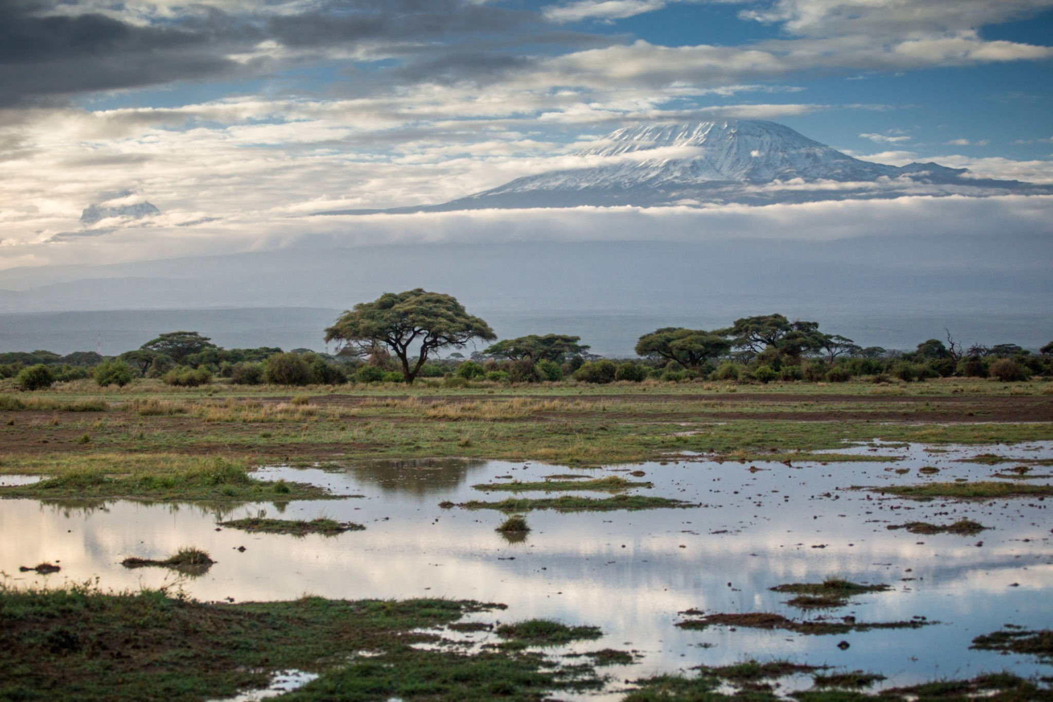
The moment of arrival at Uhuru Peak and the famous yellow summit signboard is beyond adequate description. Trekkers report emotions ranging from overwhelming joy to quiet, exhausted disbelief, from tears of pride and gratitude to a profound, wordless peace — and frequently all of these at once. The view from the summit on a clear morning is extraordinary beyond the reach of language — the plains of Tanzania stretching to every horizon, the ancient glaciers rising around you, the curvature of the earth visible on the distant horizon, the sky a shade of blue so pure and so deep that it seems impossible.
Time at the summit is typically limited to fifteen to thirty minutes — the cold, the altitude, and the length of the return journey demand that guides begin the descent promptly — but for most trekkers, even fifteen minutes at the top of Africa is more than sufficient to complete an experience that will live in the memory for the rest of their lives.
The Descent
The descent from the summit back to Horombo Hut is long, demanding in its own way, and deeply satisfying. The return to Kibo Hut from the summit takes approximately three to four hours, and the subsequent descent to Horombo takes a further three to four hours, meaning that trekkers typically arrive at Horombo Hut in the late afternoon or early evening — exhausted, proud, and deeply happy — after a day of between twelve and fifteen hours of continuous movement across some of the most dramatic and most extraordinary terrain in Africa.
Day Six: Horombo Hut to Marangu Gate
Distance, Elevation, and Duration
The final day of the Marangu Route is a long but straightforward descent of approximately 20 kilometres from Horombo Hut at 3,720 metres back to the Marangu Gate at 1,860 metres, losing approximately 1,860 metres of elevation over a walking time of typically five to seven hours. The path retraces the ascent route through the moorland and forest, and the return journey through familiar terrain has a warmly nostalgic quality — a final, leisurely opportunity to absorb the beauty of the mountain one last time before the gate, the certificate presentation, and the return to the world below.
The descent through the montane rainforest on the final day is particularly beautiful, with the warm, green, enveloping forest providing a welcome contrast to the cold and austerity of the upper mountain and a gentle, sensory re-entry into the living, breathing, richly inhabited lower world of Kilimanjaro. The certificate ceremony at the Marangu Gate — where trekkers receive their summit certificates from the park authority — marks the official end of the trek with a formality and a warmth that provides a satisfying and emotionally resonant conclusion to the journey.
Who Should Choose the Marangu Route?
The Marangu Route is an excellent choice for first-time Kilimanjaro trekkers who prefer the comfort and social atmosphere of hut accommodation over camping, who are trekking during the rainy season when the shelter of the huts offers a significant practical advantage, or who are drawn to the historical character of the mountain’s oldest and most storied path. It is also a strong choice for trekkers who prefer a gentler gradient and a more gradual physical challenge than the steeper, more demanding profiles of routes like the Machame and Lemosho.
The route’s primary limitation is its acclimatisation profile — the relatively rapid ascent of the standard five-day version results in lower summit success rates than the longer routes, and even the six-day version provides less acclimatisation time than the seven or eight-day options of the Lemosho and Northern Circuit routes. Trekkers who are known to be sensitive to altitude, who have experienced altitude sickness on previous high-altitude trips, or who are willing to invest additional days on the mountain for a better chance of summit success should seriously consider one of the longer routes.
Final Thoughts: The Marangu Route’s Enduring Appeal
The Marangu Route has introduced more people to the extraordinary experience of climbing Kilimanjaro than any other path on the mountain, and its enduring popularity speaks to genuine and substantial virtues — its beautiful and varied scenery, its unique hut accommodation, its historical significance, and its accessibility to a wide range of trekkers with varying levels of experience and fitness. It is not the route with the highest summit success rates, and it is not the route for those who prioritise solitude and exclusivity above all else.
But it is a route of genuine beauty, genuine history, and genuine character — a path that has carried countless thousands of ordinary people to the top of an extraordinary mountain, and that continues to do so today with a warmth, a familiarity, and a deep-rooted sense of occasion that no amount of newer, fancier alternatives can entirely replace. To walk the Marangu Route is to join one of the longest and most beloved traditions in all of African adventure travel — and to emerge at the summit of Africa’s greatest mountain with a pride, a joy, and a sense of personal achievement that will never, ever leave you.
Kilimanjaro Trips
Kilimanjaro Mountain Top Route
Lemosho Route
Among all the routes that ascend the magnificent slopes of Mount Kilimanjaro, the Lemosho Route occupies a position...
Machame Route
If the Lemosho Route is the connoisseur’s choice — the route selected by those who...
The Rongai Route
The Rongai Route is the only route on Kilimanjaro that approaches from the north, beginning near...
Mweka Route
The Mweka Route is occasionally used as an ascent route primarily as part of the...


%20copy%203.svg)