The Rongai Route
The Rongai Route Kilimanjaro’s Northern Wilderness Path
The Road Less Travelled
In a world where the southern approaches to Mount Kilimanjaro attract the vast majority of trekkers — drawn by the promise of the Serengeti views, the dramatic Barranco Wall, and the extraordinary botanical richness of the southern and western forest zones — the Rongai Route stands apart as the mountain’s great alternative path: the northern approach, the quieter option, the route for those who seek a different Kilimanjaro experience and are willing to follow a less beaten track to find it.
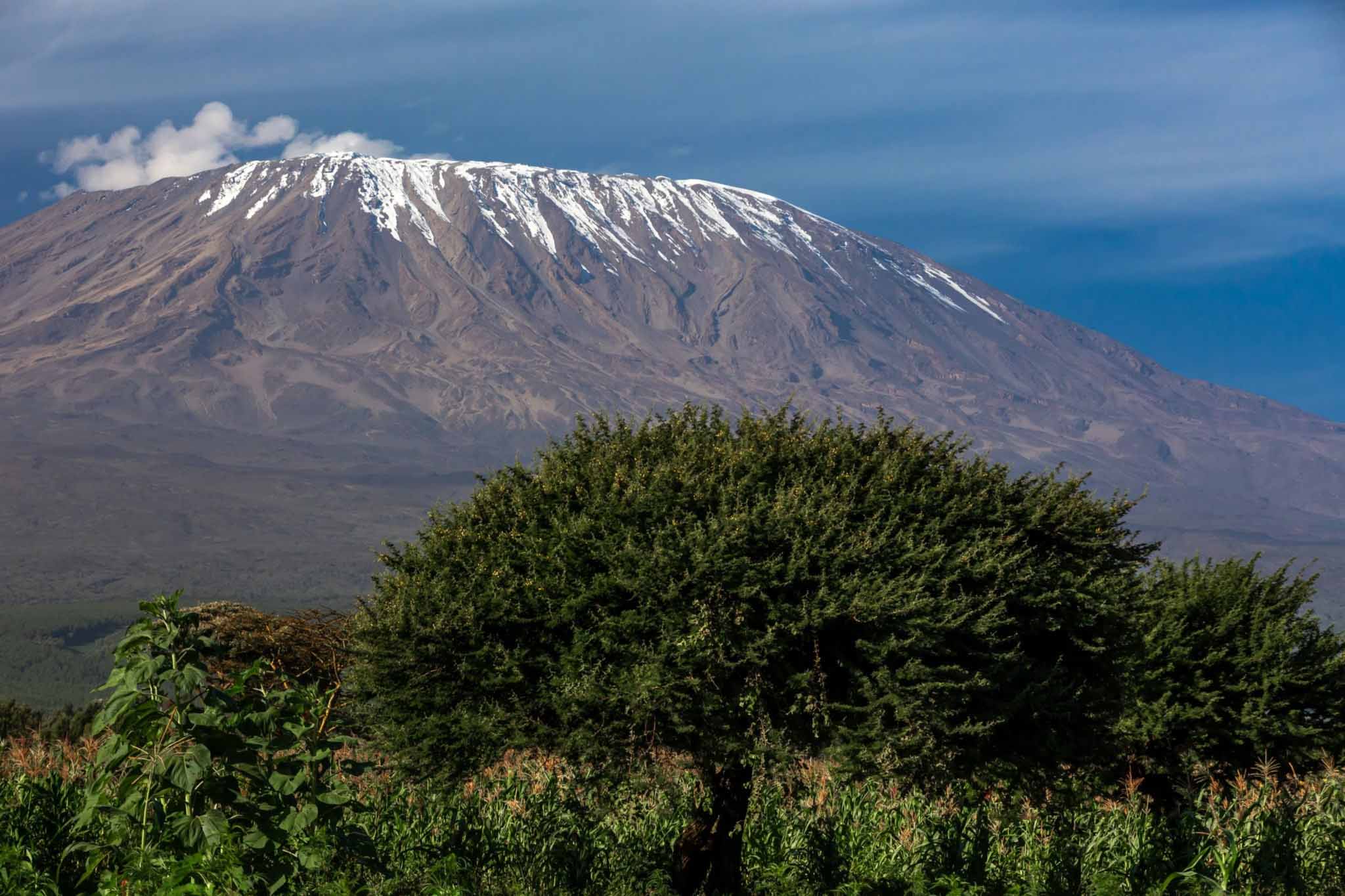
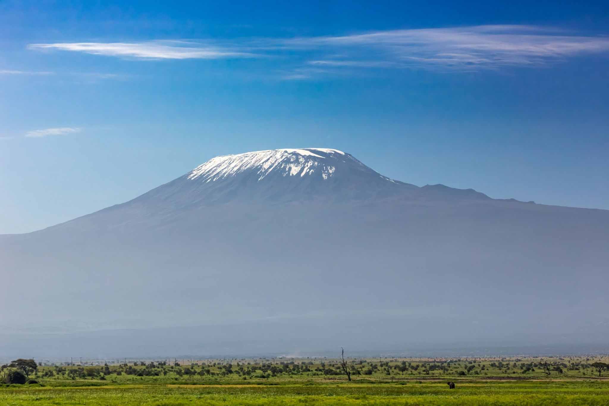
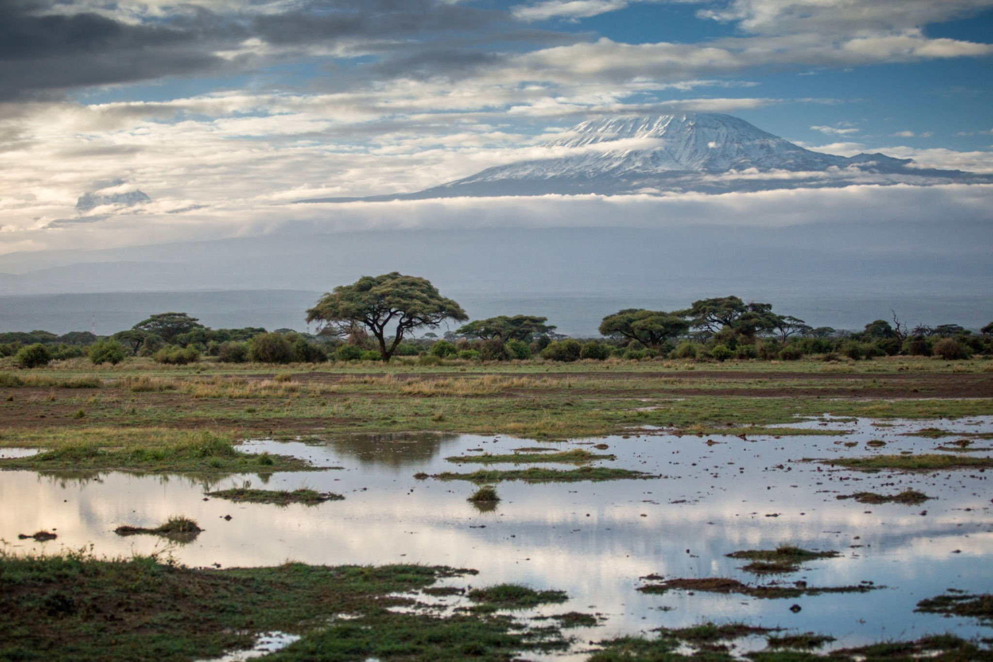
The Rongai Route is the only route on Kilimanjaro that approaches from the north, beginning near the small town of Rongai close to the Kenyan border on the northeastern side of the massif. This northern aspect of the mountain is fundamentally different in character from the lush, well-watered southern slopes that most Kilimanjaro trekkers experience — drier, more open, more sparsely vegetated, and with a landscape quality of semi-arid openness that gives the route a distinctive and quietly beautiful character entirely its own. The views into Kenya from the northern slopes, particularly in the early stages of the route, add a dimension of geographical breadth and cross-border grandeur that no other Kilimanjaro route can offer.
The Rongai Route is significantly less busy than the Machame and Lemosho routes, and this relative quietness is one of its most valued characteristics. Trekkers who prioritise solitude, who want to feel the mountain more exclusively their own, and who are drawn to the contemplative, unhurried experience of walking a less crowded path will find in the Rongai Route a quality of personal connection with Kilimanjaro that the busier southern routes, for all their magnificence, cannot always provide.
Route Overview: The Essential Facts
The Rongai Route begins at the Rongai Gate — also known as the Nale Moru Gate — on the northeastern side of Kilimanjaro National Park, located at approximately 1,950 metres above sea level near the Kenyan border. The gate is more distant from Arusha than the southern gates, requiring a journey of approximately four to five hours by road, and the logistics of reaching it are somewhat more complex. However, many operators combine the Rongai approach with a crossing of the Amboseli or Tsavo ecosystems, turning the transfer into a game drive of its own that adds significant value to the overall itinerary.
The total distance of the Rongai Route is approximately 65 kilometres for the round trip, with the ascent following the northern path and the descent using the Marangu Route on the southeastern side of the mountain. This combination of two different paths — one for ascent, one for descent — exposes trekkers to two distinct sides of Kilimanjaro and provides a satisfying variety of landscape and vegetation zone experience. The total elevation gain from the gate to Uhuru Peak is approximately 3,945 metres.
The standard duration is six to seven days, with the seven-day option incorporating an additional acclimatisation day that significantly improves the summit success rate. The six-day version is the minimum recommended duration, and trekkers who choose it should be aware that its acclimatisation profile is less generous than the seven-day Machame or eight-day Lemosho options and that altitude sickness rates are correspondingly higher.
Temperatures on the Rongai Route
The northern aspect of the Rongai Route means that the lower vegetation zones are notably drier and more open than the lush forest zones of the southern approaches, and this has implications for temperature as well as scenery. The lower forest zone on the Rongai is less dense than the southern forest, receiving less rainfall and supporting a more open, lighter woodland canopy. Temperatures in this zone range between 10°C and 22°C during walking hours, dropping to 6°C to 12°C at night — broadly similar to the southern routes but with less of the moist, enveloping coolness that the denser southern forest provides.
In the moorland zone above 3,000 metres, temperatures follow the same pattern as the southern routes — 5°C to 15°C during the day, -2°C to -8°C at night — with the northern exposure making wind a more consistent factor than on the more sheltered southern approaches. The alpine desert above 4,000 metres and the summit zone experience the same extreme conditions as on all other routes, with temperatures at the high camps dropping to -10°C to -15°C and summit temperatures during the pre-dawn push falling to -15°C to -25°C or below with wind chill.
Day by Day: The Complete Rongai Route Experience
Day One: Rongai Gate to Simba Camp
The first day of the Rongai Route begins at the Rongai Gate at 1,950 metres and ends at Simba Camp at approximately 2,625 metres — a climb of approximately 675 metres over a distance of approximately 7 kilometres, with a walking time of typically three to four hours. It is a gentle and pleasant first day, introducing trekkers to the distinctive character of the northern Kilimanjaro landscape with an easy, confidence-building walk through open woodland and cultivated areas.
The northern forest through which the path climbs on day one is immediately, strikingly different from the dense, enveloping rainforest of the southern approaches. The trees are more widely spaced, the canopy more open, and the light more generously distributed through the woodland — giving the landscape a quality of bright, open spaciousness that is immediately pleasing after the long drive from Arusha. Views into Kenya appear through gaps in the trees on the right-hand side of the path, with the flat-topped profile of the Amboseli ecosystem visible in the middle distance on clear mornings.
Simba Camp is a pleasant campsite in open woodland at 2,625 metres, with good views of the upper mountain above and the Kenyan plains to the northeast. The name derives from the Swahili word for lion — a reminder that lions range through the lower slopes of Kilimanjaro and that the mountain is part of a living, connected ecosystem rather than an isolated geological feature.
Day Two: Simba Camp to Second Cave Camp
The second day climbs from Simba Camp at 2,625 metres to Second Cave Camp at approximately 3,449 metres — a gain of approximately 824 metres over a distance of approximately 8 kilometres, with a walking time of typically five to six hours. The path continues to climb through the open woodland of the northern slopes before entering the moorland zone, the vegetation transitioning through the familiar pattern of decreasing tree height and increasing botanical diversity as altitude increases.
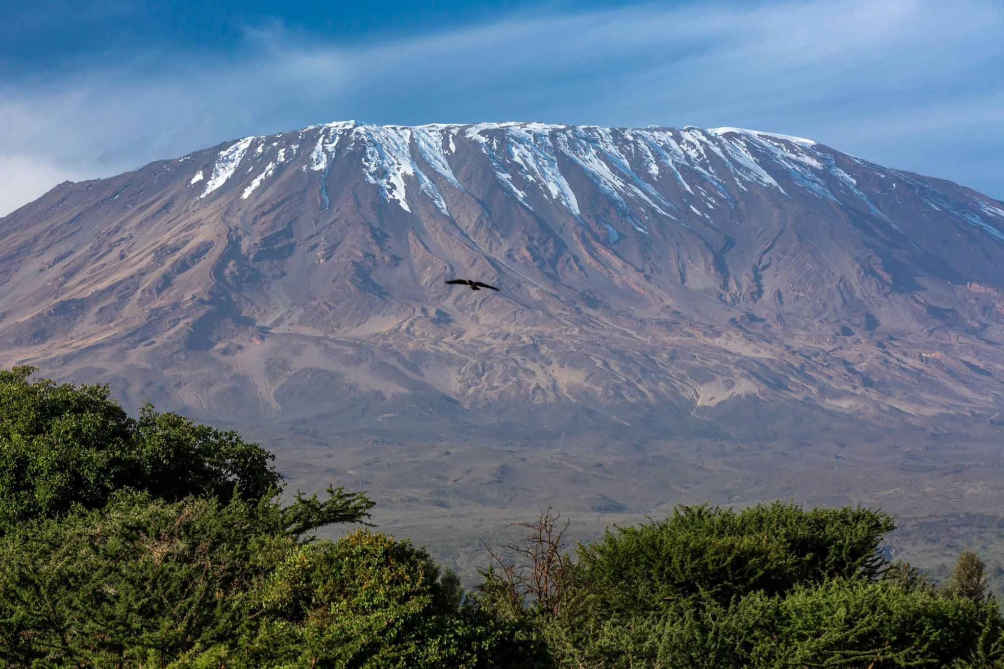
The northern moorland of the Rongai Route has a particularly open, windswept, and semi-arid character that distinguishes it sharply from the lusher, more enclosed moorland of the southern circuit routes. The giant groundsels and giant lobelias that characterise the moorland zone appear in good numbers, their extraordinary prehistoric silhouettes rising from the tussock grass against the vast, open sky. The views from the northern slopes at this altitude are magnificent — the Kenyan plains stretching to the northeast, the Amboseli swamps visible as a dark, tree-lined expanse, and on the very clearest days, the distant white dome of Mount Kenya faintly visible on the northern horizon.
Second Cave Camp takes its name from a natural rock overhang near the campsite that has historically provided shelter for trekkers and that adds a pleasantly geological character to the camp’s setting. The temperature at camp in the evening drops to between -2°C and -6°C, and the exposed northern slopes mean that wind can be a significant factor in the evening and overnight.
Day Three: Second Cave Camp to Third Cave Camp
The third day is a relatively short but important day — a walk of approximately 6 kilometres from Second Cave Camp at 3,449 metres to Third Cave Camp at approximately 3,800 metres, gaining approximately 351 metres over a walking time of typically three to four hours. The short distance is intentional — the moderate pace allows the body to continue its acclimatisation to progressively higher altitudes without the additional stress of a long, demanding day of walking.
Many Rongai Route operators incorporate an acclimatisation walk on day three — a short excursion above the camp to a higher elevation point before returning to sleep at Third Cave Camp. This application of the climb-high-sleep-low principle adds valuable altitude exposure without the fatigue of additional distance, and the views from the higher elevation point — with the summit of Kibo now close enough to feel almost reachable — provide powerful motivation and a vivid preview of the challenges and rewards that lie ahead.
Third Cave Camp at 3,800 metres is a well-established and atmospheric campsite on the open northern slopes, with dramatic views of the Kibo cone directly above and the open northern landscape stretching away below. Temperatures at camp drop to between -5°C and -10°C at night, and the importance of a quality sleeping bag rated to at least -15°C becomes fully apparent from this point.
Day Four: Third Cave Camp to School Hut Camp
Day four carries trekkers deeper into the alpine desert zone — a long, steady climb from Third Cave Camp at 3,800 metres to School Hut Camp at approximately 4,750 metres, gaining approximately 950 metres over a distance of approximately 9 kilometres and a walking time of typically five to seven hours. It is the most demanding day of the Rongai Route in terms of both distance and altitude gain, and it deposits trekkers at the highest camp on the route — the launch point for the summit push — in a state of genuine physical tiredness that makes the compulsory rest and early dinner of the late afternoon an absolute necessity rather than a luxury.
The landscape on day four is one of extraordinary, stripped-back austerity — bare volcanic rock, thin pale soil, and an almost total absence of vegetation above approximately 4,200 metres. The sky at this altitude is a deep, saturated blue of extraordinary intensity, the air is thin and dry, and the scale of the Kibo cone — now filling the sky ahead and above — is genuinely impressive and genuinely humbling. School Hut Camp sits on a broad, exposed ridge at 4,750 metres with unobstructed views of the summit above and the northern plains stretching away below, and the temperature at camp in the evening plunges to between -10°C and -15°C, making full cold-weather layering an immediate and non-negotiable priority on arrival.
Day Five: School Hut Camp to Uhuru Peak and Descent to Horombo Hut
The summit day of the Rongai Route follows the same fundamental structure as on all other routes — the midnight departure, the long climb through darkness and cold, the arrival at the crater rim, and the triumphant, overwhelming, life-defining moment at Uhuru Peak as dawn breaks over Africa. The Rongai Route approaches the crater rim via Gilman’s Point — the same crater rim arrival point as the Marangu Route — before continuing along the rim to Stella Point and ultimately Uhuru Peak.
After the summit, the descent follows the Marangu Route path down through the alpine desert to Horombo Hut at 3,720 metres — a descent of approximately 2,175 metres over approximately 15 kilometres that typically takes between six and eight hours from the summit. The arrival at Horombo Hut in the late afternoon, exhausted and proud and overwhelmed, marks the beginning of the final chapter of the Rongai Route experience.
Day Six: Horombo Hut to Marangu Gate
The final day follows the Marangu Route descent path from Horombo Hut at 3,720 metres to the Marangu Gate at 1,860 metres — approximately 20 kilometres over five to seven hours of forest and moorland walking, arriving at the gate for the certificate presentation and the conclusion of the trek.
Why Choose the Rongai Route?
The Rongai Route is the ideal choice for trekkers who value solitude and a quieter, more contemplative mountain experience, who are drawn to the distinctive landscape and cross-border views of the northern slopes, who are trekking during the long rains when the drier northern aspect offers a practical weather advantage over the wetter southern routes, and who want a genuine Kilimanjaro experience that feels meaningfully different from the well-trodden southern circuit. It is a route of real beauty, real character, and real rewards — a path that offers Kilimanjaro’s summit by a less celebrated but no less worthy road.
Kilimanjaro Trips
Kilimanjaro Mountain Top Route
Marangu Route
Among all the paths that wind their way up the slopes of Mount Kilimanjaro, the Marangu Route holds...
Lemosho Route
Among all the routes that ascend the magnificent slopes of Mount Kilimanjaro, the Lemosho Route occupies a position...
Machame Route
If the Lemosho Route is the connoisseur’s choice — the route selected by those who...
Mweka Route
The Mweka Route is occasionally used as an ascent route primarily as part of the...


%20copy%203.svg)